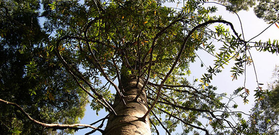

Kauri Tree (Agathis australis) in the Rahui Kahika Reserve.
Trevor H. Worthy and Stephen E. J. Swabey, Avifaunal changes revealed in Quaternary deposits Near Waitomo Caves, North Island, New Zealand, Journal of The Royal Society of New Zealand, Volume 32, Number 2, June 2002, pp 293–325.
M. Horrocks, Y. Deng, S. L. Nichol, P. A. Shane, and J. Ogden, A palaeoenvironmental record of natural and human change from the Auckland Isthmus, New Zealand, during the late Holocene, Journal of The Royal Society of New Zealand, Volume 32, Number 2, June 2002, pp 337–353.
Mark Horrocks, Paul Augustinus, Yanbin Deng, Phil Shane, Sofia Andersson, Holocene vegetation, environment, and tephra recorded from Lake Pupuke, Auckland, New Zealand, New Zealand Journal of Geology & Geophysics, 2005, Vol. 48: 85–94.
Michael King, The Penguin History of New Zealand, Penguin Books, 2003.
Anna Sandiford, Mark Horrocks, Rewi Newnham, John Ogden, and Brent Alloway, Environmental change during the last glacial maximum (c. 25 000–c. 16 500 years BP) at Mt Richmond, Auckland Isthmus, New Zealand, Journal of The Royal Society of New Zealand, Volume 32, Number 1, March 2002, pp 155–167.
History has left its trace in the dirt - the type and location of pollen grains in core samples in relation to signature layers of volcanic debris tells us about the local environment at the time they were deposited. The most recent 2005 study from cores taken at Lake Pupuke on the North Shore contain a near-complete record of the vegetation in the region for the last 9500 years. Confirming other similar recent studies, it dates a massive deforestation across the isthmus associated with human activity, up to a century before the Rangitoto eruption 700 years ago. Humans had arrived.
Prior to the arrival of humans, the entire region was covered in dense and undisturbed kauri/rimu forest, which came to dominate over the last 7000 years as the environment in the region became drier. This forest was full of birds such as moa, kakapo, weka, and brown teal. Throughout this period the ecosystem changed very little, suggesting that the environment was quite stable. At Lake Waiatarua in central Auckland, there was no significant charcoal in core samples covering the last 12000 years, showing that the Auckland region had very few naturally occurring fires, unlike Northland that was drier and had regular infernos throughout this period.
Except for the occasional volcanic eruption, that is. I've already mentioned the Rangitoto eruption, which made its presence felt at Lake Pupuke. It affected only a limited area in any substantial way, like most eruptions in the Auckland volcanic field.
Eruptions from further south around Rotorua, Taupo, and Taranaki were much larger and of more general threat. The core sample at Lake Pupuke records a substantial change in the environment associated with the last great Taupo eruption 1800 years ago. This eruption was possibly the largest on Earth in the last 5000 years, and appears in both Chinese and Roman records. The forest canopy was seriously damaged, which was reflected in a sharp drop in kauri pollen and an associated rise in kahikatea pollen, which is known to colonise waterlogged sites following disturbance.
Earlier than this many other major eruptions left their mark on the Auckland landscape, such as Tuhua (c. 6,100 years ago), Rotoma (c. 8,500 years ago), Okareka (c. 18,000 years ago), Kawakawa (c. 22,500 years ago), and Okaia (c. 23,500 years ago).
About 10,000 years ago, the forest in the region was restricted to localised patches in extensive shrubland/grassland. Temperatures may have been 4-5°C colder than now.
Even earlier, at the height of the last ice age around 25000 years ago, Auckland was dominated by beech forest. Canopy conifers like today were present, but formed only a minor part of the local forest, which was full of birds such as moa, North Island goose, New Zealand coot, North Island takahe, Finsch's duck, and North Island kokako, as found in Gardner's Gut Cave at Waitomo. In fact, the presence of kokako, saddleback, and robin, and the absence of grassland birds such as pipit and quail suggest that the vegetation about Gardners Gut Cave included tall shrubland and probably not much grassland, even over the peak of the last ice age. Much of the ancestral Auckland ecosystem moved north to survive.