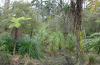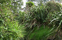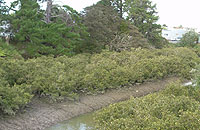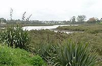
2. Craigavon Park.
3. Shadbolt Park, Portage Road.
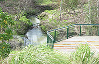
4. Olympic Park, Wolverton Street, New Lynn.
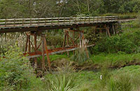
5. Railway bridge crossing Te Whau and Olympic Park.
6. View from the Whau bridge, Great North Road, New Lynn.
7. Ken Maunder Park, Rata Street, New Lynn.
8. Looking up the Rosebank Peninsula from Ken Maunder Park, Rata Street, New Lynn.
Go on a virtual tour through Te Whau portage. Download this Google Earth file.
Dick Scott, Fire On The Clay – The Pakeha Comes To West Auckland, Southern Cross Books, Auckland, 1979.
A. E. Tonson, Old Manukau, Tonson Publishing House, Auckland, 1966.
R. C. J. Stone, From Tamaki-Makau-Rau To Auckland, Auckland University Press, 2001.
B. W. Hayward and J. T. Diamond, Prehistoric Archaeological Sites of the Waitakere Ranges and West Auckland, New Zealand, Auckland Regional Authority, 1978.
William R. Wade, A Journey in the Northern Island of New Zealand, 1842.
John Lifton, Cornwallis, 2002, p16-17.
William White, Important information relative to New Zealand, Sydney, T. Brennard, 1839.
C. Heaphy, Sketches of the past generation of Maoris, Chapman's New Zealand Monthly Magazine, August 1, 1962, p4-5.
F. D. Fenton, Important Judgements 1866-1879 Delivered in the Compensation Courts and Native Land Courts, Orakei, Auckland, December 22, 1869.
R. Daamen, P. Hamer, B. Rigby, Waitangi Tribunal Rangahaua Whanui Series District 01 - Auckland.
Perhaps these early settlers didn't clear fell the timber in my backyard? It seems that large tracts of the area may have already been deforested before the Europeans even arrived, and Green Bay was kauri gumland like most of the Waitakere foothills, covered in windswept fern and manuka/kanuka scrub, backing onto the still densely wooded Waitakere Ranges.
"Wade describes the route he was led over in 1838, when walking between the Kaipara and Manukau Harbours. The northern section followed the Riverhead Portage which was left near Kumeu. From here 'the path passed over short easy hills with white clayey soils and kauri resin ... the track was 4-5 miles from the west coast with a view of the Waitemata to the east not far away...' and finally met the Whau Portage. The description is of a track passing over the eastern foothills of the Waitakere Ranges, roughly in a line joining present-day Kumeu, Taupaki, Waitakere, Swanson, Henderson Valley, Oratia and Titirangi Golf Course."
B. W. Hayward and J. T. Diamond, Prehistoric Archaeological Sites of the Waitakere Ranges and West Auckland, New Zealand, Auckland Regional Authority, 1978, p95.
"Occasionally we had to pass through narrow lines of kauri wood, which crossed our path. The kauri here appeared of a much less aspiring growth than in a more northern latitude. The short swamps which came in our way were not serious impediments, and on the whole, we found the road from Kaipara to Manukau easy travelling...
I was on ahead, with two or three of the lads, when some of the hindermost ones struck off into a path to the left, and were proceeding on before we were aware of it. We had therefore to beat our way through the bush, which proved excessively fatiguing, and completely wore out my upper leathers. We now had Manukau in sight, and soon arrived at the road over which the natives drag their canoes.
There is a remarkable facility of water conveyance in this part of the Island. With perfect ease canoes can be dragged over the short distances between one river and another; so that the tribes of the Thames on the east coast can pass over to Manukau on the west, and thence on to Waikato. From Waitamata, in the Thames, canoes are brought to Manukau over the dragging-place on which we were travelling. Crossing Manukau harbour, they pass up a river or creek, which brings them within so short a distance of the Awaroa, a branch of the Waikato river, that another easy drag puts them in a position either to go out to sea by Waikato heads, or to paddle on beyond Mangapouri, upwards of a hundred miles up the river."
William R. Wade, A Journey in the Northern Island of New Zealand, 1842, p76.
The first recorded land sale actually took place before the Treaty of Waitangi was even signed:
"The lands which we now know as Avondale, Waterview and Blockhouse Bay had been included in a sales deed dated 11th January 1836 between Thomas Mitchell - an entrepreneur originally from New South Wales but based in the Hokianga, and Apihai Te Kawau of Ngati Whatua Nga Oho, Wetere Te Kaue of Ngati Tamahoa Waiohua, Te Tinana and Tamaki Rewiti. This was later brought under dispute in 1840 as it had been made prior to the Treaty of Waitangi, and not approved by the government land commissioners."
John Lifton, Cornwallis, 2002, p16-17.
Thomas Mitchell sailed into the Manukau harbour on board the Fanny, captained by Captain Thomas Wing, who later became the first Manukau harbourmaster. Along with them was Reverend William White, who brokered the deal with Ngati Whatua, and waxed fancifully about the idyllic surroundings:
"Near the source of these rivers, the Cowdy timber is found in the greatest perfection, and in this delightful district are to be met with some of the most sublime and romantic scenery the eye of the admirer of the picturesque beauties of nature need desire - mountains with their snow-clad summits, whose sides are covered with gigantic trees - rivers with their innumerable cataracts and lakes, and rich and beautiful valleys..."
William White, Important information relative to New Zealand, Sydney, T. Brennard, 1839.
However in a letter later on that same year, the then south Manukau-based missionary William Woon let slip the real motivation for the vast land purchase:
"It is expected that several Englishmen, traders, will take up their residence in this harbour, as on the north side there are large and extensive forests of timber, a greater part of which has been already purchased and no doubt vessels will be here to fetch it for the Sydney and Hobart Town markets."
William Woon, In T. B. Byrne, Wing of the Manukau, Auckland, 1991, p61.
The first Europeans known to pass through Green Bay were missionaries James Hamlin and Arthur Nesbitt Brown. Travelling from Waimate to the Waikato with a party of nineteen Maori, they reached Green Bay on 12 March 1834, and camped the night before carrying on across the Manukau by canoe. According to Hamlin's diary, they had a terrible time on the beach and in the fern, despite the fine weather.
At this time no Maori were living in the Auckland isthmus out of fear. The Ngati Whatua had been decimated and scattered by invading Northland tribes seeking revenge for earlier injustices during the musket wars.
"In 1827 Te Parawhau, under Tirarau, attacked Apihai and party at Waiaro near Mahurangi. Te Taou and Ngaoho fled to the mountains, then to Orewa, past Takapuna to Te Whau and to Woods’ Island (Pahi) and then to Kopapaka (Henderson’s Mill) where they settled. At that time Te Uringutu were living with Ngati Paoa at Wharekawa. Te Taou and Ngaoho were then taken by Te Uringutu in Ngati Paoa canoes on to Haowhenua near Maungatautari, where they stayed until Ngati Paoa were expelled in 1831. ...Ngapuhi also attacked Te Aotea, Great Barrier Island, that year and killed Ngati Maru chief Te Maunu and his son Ngahua."
R. Daamen, P. Hamer, B. Rigby, Waitangi Tribunal Rangahaua Whanui Series District 01 - Auckland., p79.
Judge Fenton records that Ngapuhi dragged their waka through Te Whau portage in 1824, on their way to make peace with tribes in the Waikato.
"The petty bickering between tribes all around the country at this time is well illustrated by a detailed account involving the Waitakeres, recorded by Heaphy (1862).
Around 1800, a party of Waikato Maoris (Ngatiteata) raided the Coromandel Peninsula, killing many inhabitants at Kauaeranga, Opou, and Great Barrier. The Coromandel people planned their revenge and waited until the Ngatiteata (whose home was around Waiuku) were camped on the north Manukau shores, shark hunting with the Ngatiwhatua on the headwaters of the Waitemata around Whau and in the Manukau.
The Coromandel Maoris left in the evening with eleven canoes full of warriors. They hid the first day at Ponui and then paddled to Rangitoto where they hid during the second day. That night they paddled up the Tamaki Estuary and over the portage to the Manukau and by early morning passed Onehunga on their way down the harbour.
'When we got off the tall cliffs which is the Whau (portage), their dogs barked, but those of the Waikato who first saw us, thought we were only some who had been also shark fishing and were coming down with the tide. More than half our people lay down in the bottoms of the canoes and the wind took us along quickly. The Waikato's canoes were drawn up on the beach between the cliffs and the drying place where their sharks were hanging on stages in great numbers; their old women were beginning to prepare their hangis. We sprang onto the beach before they were prepared for fighting, some ran to their canoes and some ran inland but we sent a party of our tribe over to the Waitemata side, while others of us were fighting on the beach and on the hillside.' They killed all they could find in both places."
B. W. Hayward and J. T. Diamond, Prehistoric Archaeological Sites of the Waitakere Ranges and West Auckland, New Zealand, Auckland Regional Authority, 1978, p12.
C. Heaphy, Sketches of the past generation of Maoris, Chapman's New Zealand Monthly Magazine, August 1, 1962, p4-5.
Judge Fenton recorded another battle in 1792 at Rangimatariki, a papakainga (village) at the end of the Rosebank Pensinsula, near the current-day Patiki Road interchange:
"...in which Ngatipaoa were defeated with heavy loss: 'You may see hangis (ovens) to this day', says Tamati Tangiteruru. Apihai says that this engagement was to avenge the deaths at Mahurangi, but this can scarcely be, for Ngatipaoa appears to have been the attacking party."

